Leica FlightPro can display a map layer on the following views:
-
North-up
-
Nose-up
-
Project
An introduction to the use of maps is given in section https://hexagon.atlassian.net/wiki/spaces/FPDOC/pages/45146637788/Software+Global2+Configuration#Maps-Selection-configuration.
For instructions on how to:
-
Define which map Leica FlightPro selects for display see section https://hexagon.atlassian.net/wiki/spaces/FPDOC/pages/45146637788/Software+Global2+Configuration#Maps-Selection-configuration.
-
Define the content which Leica FlightPro displays on the map layer see section https://hexagon.atlassian.net/wiki/spaces/FPDOC/pages/45146637788/Software+Global2+Configuration#View-Configuration.
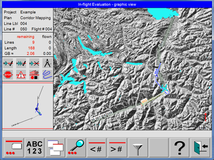
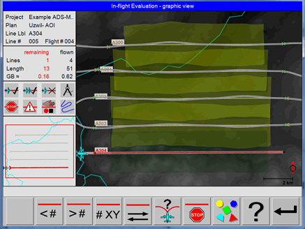
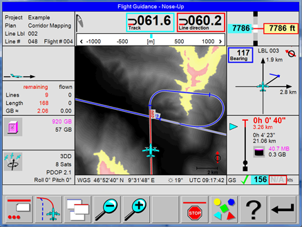
Examples of views with data displayed on the map layer
|
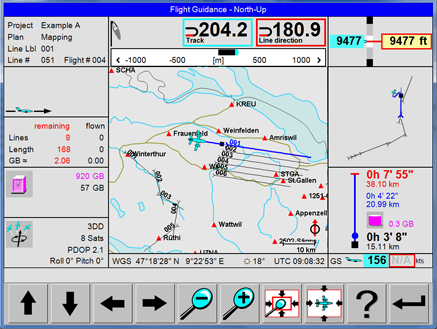
North-up view with vector data
|
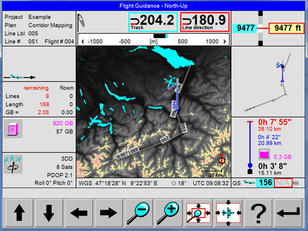
|
North-up view with Elevation Encoded bitmap |
|
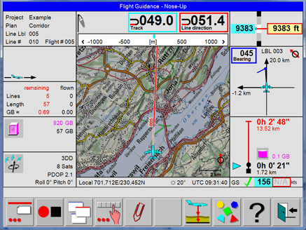
Nose-up view with bitmap Map |
|
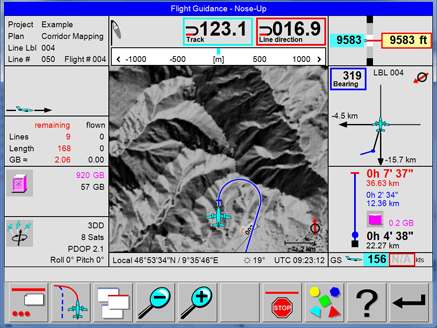
|
Nose-up view with Shaded Relief bitmap |
Examples of views with map layer displayed
|
Project Status view with Shaded Relief bitmap |
|
Project Status view with Elevation Encoded bitmap and real-time coverage |
|
Elevation Encoded maps generated by Leica FlightPro are colour-coded, if displayed on the OC61 Operator Console. See section https://hexagon.atlassian.net/wiki/spaces/FPDOC/pages/44731203734/Backdrop+Maps#Colour-coding-of-SRTM-DTM-data-if-displayed-on-the-Operator-Console and https://hexagon.atlassian.net/wiki/spaces/FPDOC/pages/44731203734/Backdrop+Maps#Coding-of-SRTM-DTM-data-if-displayed-on-the-Pilot-interface The example on the left side shows that the path of the shortest approach passes terrain which is - according to the SRTM DTM data - close or above the current flying height of the aircraft. |
For safety reasons, Elevation Encoded maps are not colour-coded if displayed on the Pilot interface.
Colour coding of SRTM DTM data if displayed on the Operator Console
|
Colour code |
Height range in displayed image |
|
|---|---|---|
|
minimum height |
maximum height |
|
|
Black to white |
Any height from lowest terrain up to 300 m (985 ft) below the aircraft |
300 m (985 ft) below the aircraft |
|
Yellow |
300 m (985 ft) below the aircraft |
100 m (330 ft) below the aircraft |
|
Light red |
100 m (330 ft) below the aircraft |
Any height above the aircraft |
Coding of SRTM DTM data if displayed on the Pilot interface
|
Colour code |
Terrain height |
Remarks |
|---|---|---|
|
Black |
Lowest terrain in displayed image |
Can be any height in the range from below the current aircraft flying height to above the current aircraft flying height |
|
White |
Highest terrain in displayed image |