Skip table of contents

Image Index Viewer

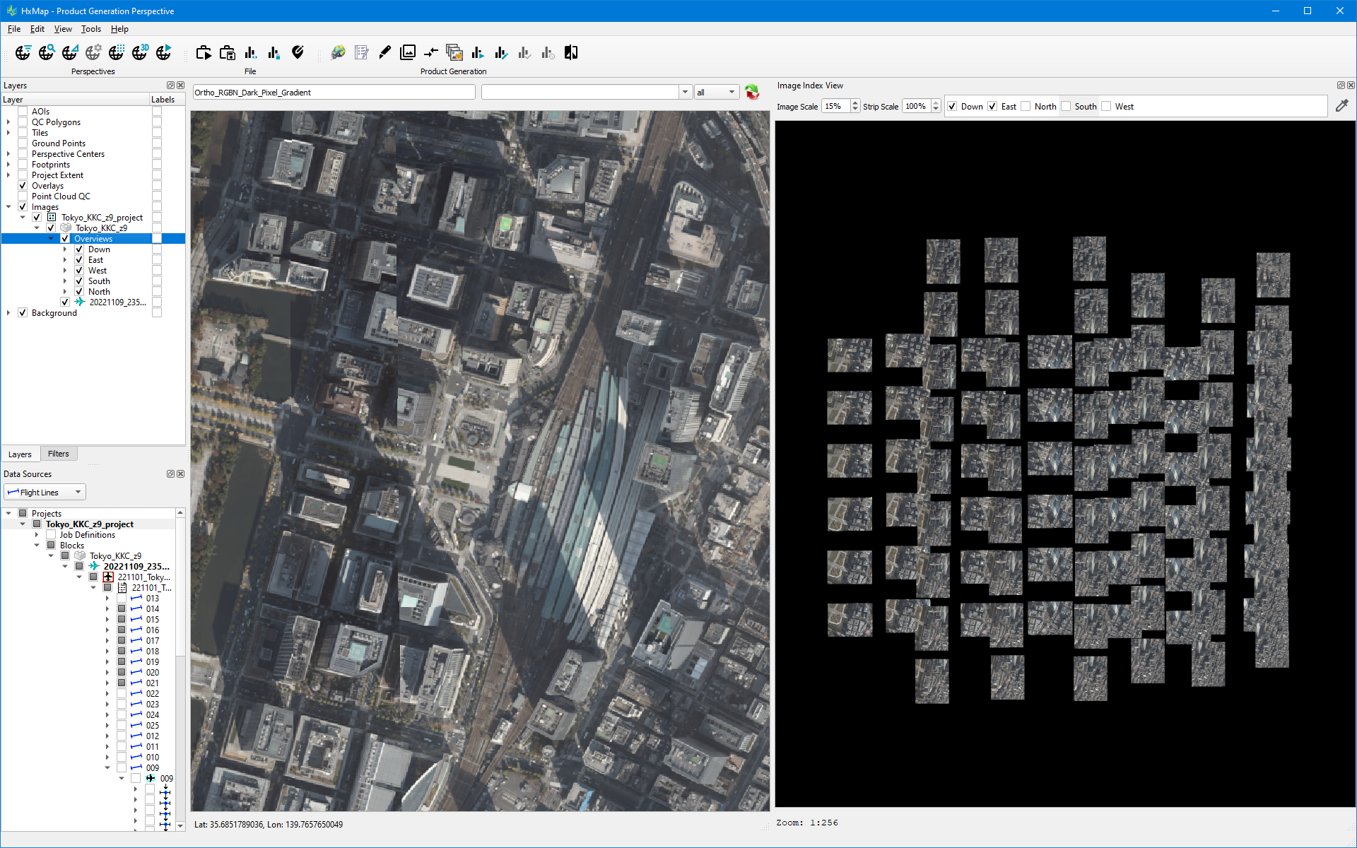
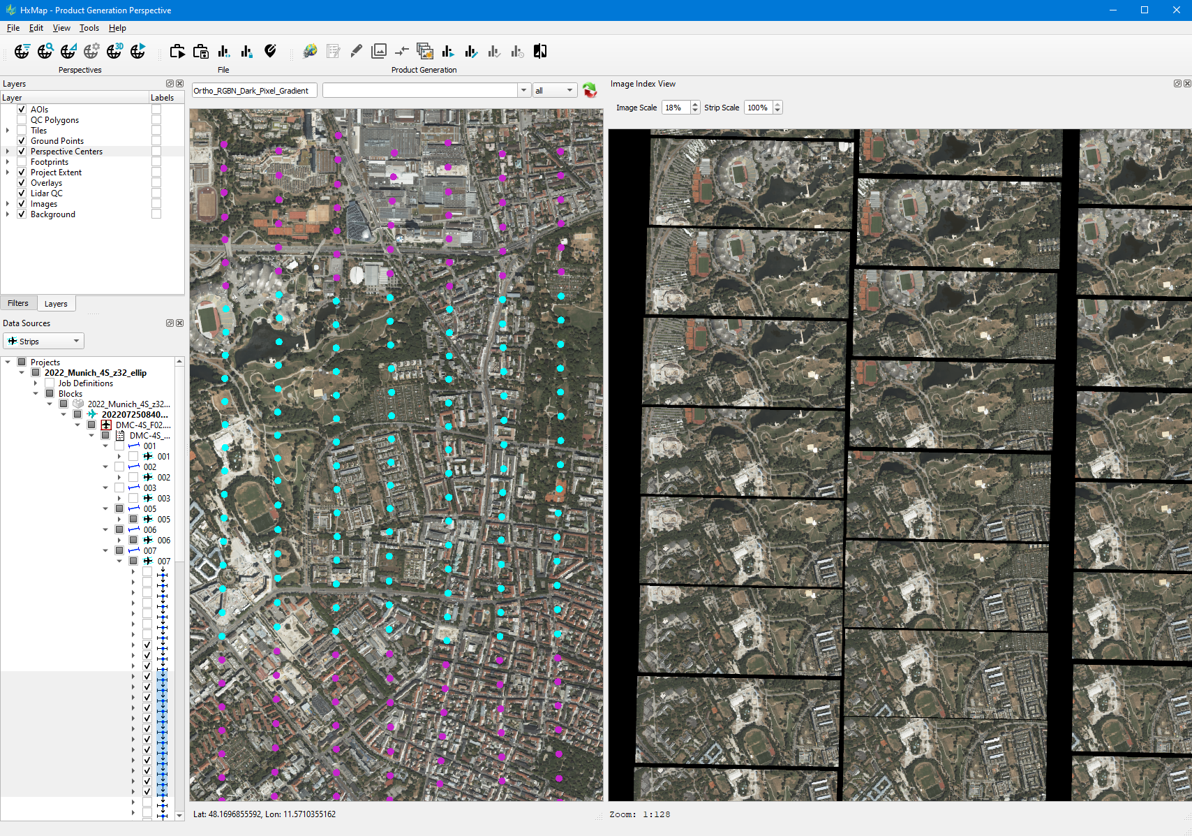
The Image Index Viewer allows to assess radiometry for a selection of images in the project. Images displayed in the viewer are oriented relative to flight line direction, where the top of the viewer is the direction of flight. Two image scaling modes are possible to support assessment of individual images within a strip and between strips. Nadir and oblique images can be displayed

Controls for Image Index Viewer

Task

Steps

Example

Load Images to Viewer

  1. Select images in Map Window or Data Source

    1. Selection of overlapping images in ground space can be achieved by choosing the Images → Overviews entry in Layer view for selection

  2. Load selected images by:

    1. Right mouse button context menu in Map Window, Display Selected Images

    2. Keyboard shortcut Ctrl+W

  3. 100 images will be loaded by default. The image limit can be adjusted as described in Application Settings

  4. Keyboard shortcut for image loading can be modified Defining keyboard shortcuts

image-20250103-163320.png

Scale Images in Viewer

  1. Adjust the Image Scale by Shift + mouse scroll wheel or the key-in field

  2. Adjust the Strip Scale by Ctrl + mouse scroll wheel or the key-in field

  3. Adjust view zoom level by mouse scroll wheel

  4. Mouse settings for Image and Strip scale can be modified Zooming and Panning

image-20240202-210834.png

Sample color from Images

  1. Activate Image Color Sampling mode by the tool bar button

  2. Shift + left click on the image to see the 8-bit pixel value.

  3. Samples are preserved in the list until the tool is deactivated or until new images are loaded into the view.

image-20250103-170155.png

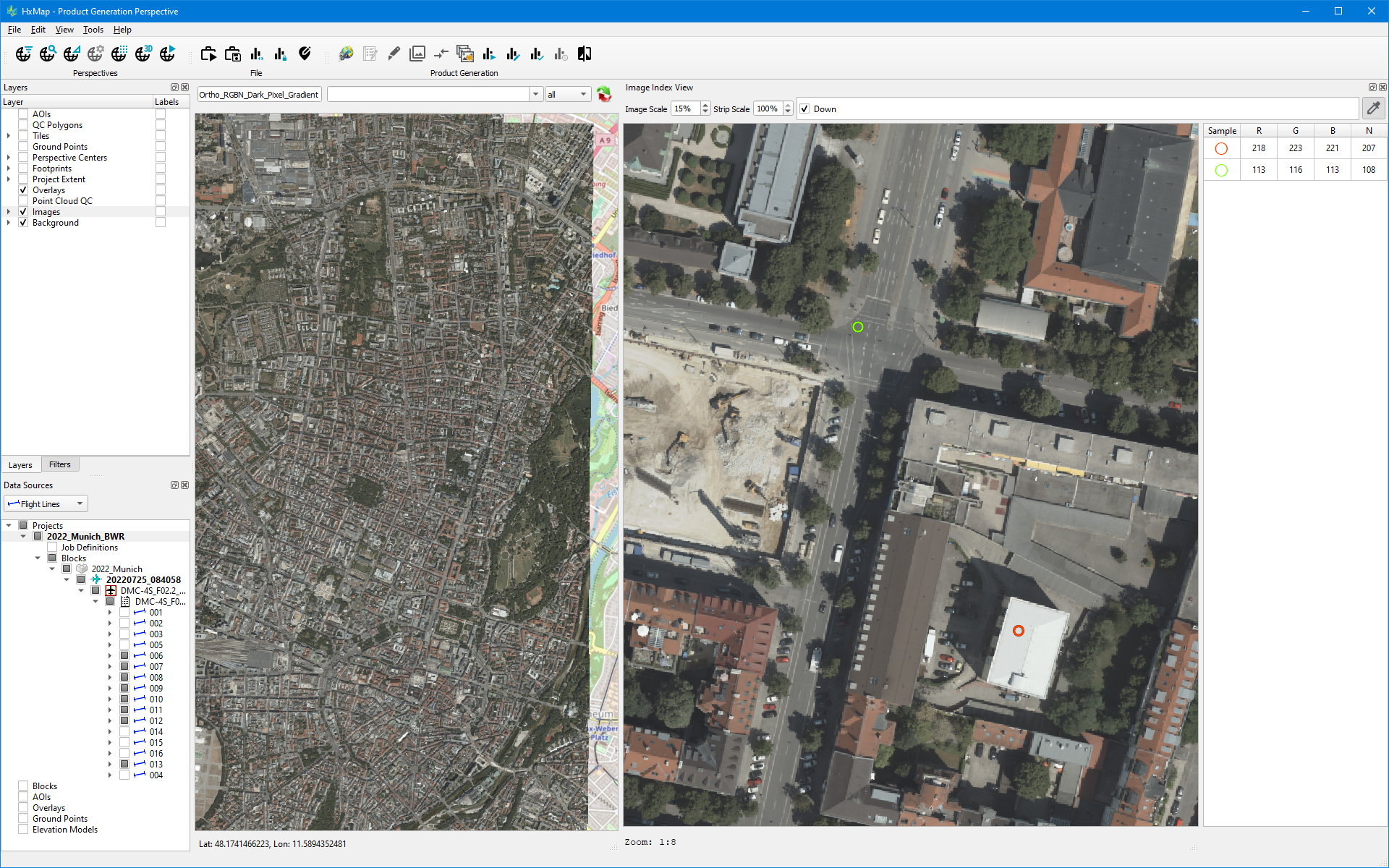
The selection of images for display in Image Index View may be changed while the Regional Radiometry Edit tool is active.

JavaScript errors detected

Please note, these errors can depend on your browser setup.

If this problem persists, please contact our support.