Managing Ground Points
Different workflow steps within HxMap allow to provide ground points as control for processing. HxMap requires ground points to be in hexgp format. Additionally points can also be imported to the workflow manager, which makes them available throughout all perspectives.
Importing Ground Points
To import ground points to the workflow manager, select “Tools” > “Import Ground Points” in any of the perspectives.
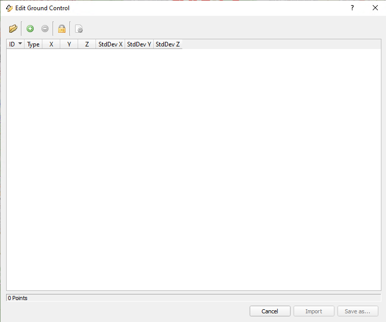
The toolbar of this tool allows the following options:
Import points from file: allows to read in points from a hexgp or txt file
Add/Delete point: allows to manually edit the list by either adding points or deleting them
Lock points: when toggled, locks the X/Y/Z columns to prevent the coordinates from being edited
Set default value: allows to enter default value for standard deviation for new points
Double-clicking into a field allows to change the entry of that field.
Importing points from a text file
If needed, review and set the standard deviation to apply to the points you are about to import.
HxMap supports importing ground points that are given in a tab seperated text file with the following columns:
ID of point
X coordinate
Y coordinate
Z coordinate
StdDev X (optional)
StdDev Y (optional)
StdDev Z (optional)
Text file is expected to be without header.
Sample ASCII file:
P01    514926.258      5444001.098     203.256      0.03 0.03 0.04
P02    515235.123      5444042.125     202.589      0.03 0.03 0.04
P03    515473.543      5444088.256     204.875 	    0.03 0.03 0.04
HxMap will ask the user to specify which coordinate reference system the coordinates are given.
After importing the points, edit them as necessary and save the list as new hexgp file. The hexgp file is then automatically added to the “Ground Points” section of the data source tree.
Importing points from a hexgp file
Process for importing points from a hexgp file is similar to importing from a text file, with the following differences:
HxMap will not ask for a coordinate reference system as this information is already stored within the file
It is possible to directly import the file “as-is”, unless the user has performed changes to the list
Manually add Ground Control Points
Use the green "+" symbol to add a new ground control. It will add a new line with default values. By clicking into the individual fields, you can edit the desired values.
Delete Ground Control Points from the List
Select one or several lines from the table and use the red "-" symbol to delete.
Edit Standard Deviation for Multiple Entries
Select several lines from the table, move the mouse cursor into the StdDev X column and perform a right mouse-click. A small dialog opens, which allows to set a new value for all selected items. Repeat for columns StdDev Y and StdDev Z, if necessary.