Exporting 3D models
The 3D Model products generated by HxMap are delivered in an internal *.tdc file format. The TDC format is required by the HxMap 3D Editor and process of texturing. In order to use the final 3D model objects in a GIS environment or other 3rd party software, it's useful to convert the data into a common format. The Export 3D model tool allows converting TDC into OBJ or CityGML file format.

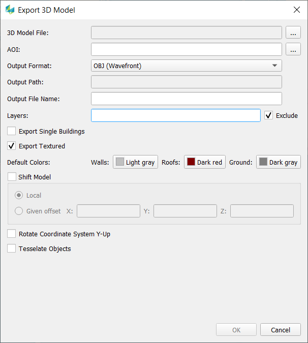
After selecting a 3D Model file (*.tdc) you have following options:
Customize the output path
Define an AOI (*.shp).
If no AOI is defined the whole area of the input data are exported.
If the shape file contains multiple polygons multiple export files will be generated.
Pick the desired output format
Define layers to be in-/excluded (e.g. 1,3, 5-9)
Export objects as single building files (Object ID is used to define which parts belong to one building)
Define default colors for untextured roof, wall or ground faces
The OBJ export has additional options:
Shift of the 3D Model to a local origin or with a given offset
Rotation of the coordinate system (Y-Up) and a new tessellation of the geometry is possible.
CityGML can be exported in version 1.0 and 2.0. The spatial reference system can be defined by a text string (srsName) but the correctness will not be checked.